Water harvesting and food growing at Mzomoyethu Crèche: tanks, swales and a holding pond supply protected growing areas, with irrigation monitored using a timer and water meter.
Site overview · 10 min 46 · Mzomoyethu Crèche, KwaGudlintaba
Mzomoyethu Crèche Garden
Water harvesting and food growing at Mzomoyethu Crèche: rainwater tanks, swales, a pond, mulched beds, living groundcover and protected seedlings. Site footage records the swale filling during a 45 mm storm; calculated storage estimates are presented separately from measured performance.
Read the clip transcript
Mzomoyethu Crèche Garden. A garden designed around water. In KwaGudlintaba, in northern KwaZulu-Natal, this project brings water harvesting and food growing together. The fenced compound covers roughly eighteen hundred square metres. The garden includes shaded vegetables, staple crops and fruit trees, with paths and the crèche alongside. Rain is concentrated in summer, with much drier winters. The long-term estimate here is about seven hundred and eighty millimetres a year. Storing rain and soil moisture helps bridge the dry months. Mzomoyethu Crèche, before the earthworks. The design starts with water. Contours follow equal heights across the slope. Level swales and downhill berms are built to catch and hold runoff. Planting follows the water-harvesting layout. When rain arrives, the roofs collect water and feed it into the tanks. Runoff from the slope is intercepted and held in the swales. The animation shows controlled overflow moving through the system towards the pond. The pond stores water while the swales let moisture enter the ground. After the rain, stored water supplies drip irrigation. Now let's look more closely. Rain brings water to the site. The four tanks store seventeen thousand five hundred litres of roof water. Runoff also arrives from the road and the slope above. Narrow diversion mounds guide it gently into the swales. The report records about two hundred and twenty metres of swales. Their downhill berms hold runoff, giving it time to soak in. The fruit trees have half-moon basins, open uphill. Runoff collects inside and moistens the soil around their roots. Maize grows across the slope. With groundcover between the rows, these plantings slow runoff, protect the soil, and help water soak in. A full swale releases excess water through a controlled outlet into the pond. The lined pond stores twelve thousand litres and receives controlled overflow. The rain stops. Let's look beneath the ground. Seen from the side, runoff travels down the slope above and collects in each swale. Water slowly enters the soil, spreading downwards and sideways beneath the swales. Tree roots take up moisture stored between soil particles, helping the trees through drier periods. With repeated rains, water may seep below the roots and replenish groundwater, where soil and rock conditions allow. In an average year, about one point four million litres of rain fall inside this fence. A single forty-five millimetre event brings about eighty thousand litres. Only part is available to harvest. The tanks and pond provide twenty-nine thousand five hundred litres of storage. With regular use, the roof could collect about fifty-nine thousand litres a year in this example, before storage overflow. The swales have a rounded base and a downhill berm. The trenches were about eighty centimetres wide and half a metre deep. If that shape extended along all two hundred and twenty metres, filling to ground level would hold roughly fifty-nine thousand litres. Prunings and organic material mulch the swale base, helping keep it soft as water soaks in. They also occupy space, so usable water storage is less than the empty-trench estimate. During this forty-five millimetre rain, the whole swale filled. That is what was observed on site. Runoff from the land above and the road feeds the system. The amount captured was not measured, so we should not put a modelled litre figure on this event. About eighty-one thousand litres of rain fell inside the fence during that storm. Outside runoff also contributes. One observed fill does not tell us the annual harvest. That needs records of further fills, infiltration and overflow. Water transferred into the pond is counted only once. Here is the work on site. Real footage shows runoff crossing the ground after rain. The swales catch this water and give it time to soak in. These photographs show the lined pond being built, and then holding rainwater. Water also collects in the swales around the growing areas. Drip irrigation delivers stored water slowly to the raised beds at the crèche. By June twenty twenty-two, the aerial view shows the tanks, the pond and the garden under shade cloth. The same ground, almost three years apart: July twenty nineteen and June twenty twenty-two. Keeping water in the garden also means caring for the soil. Dry mulch shields the soil from sun and heavy rain. It reduces evaporation, suppresses weeds, and adds organic matter as it breaks down. At Mzomoyethu, living groundcover protects the soil around the trees. Sweet potato provides food as well as cover. Along with sour fig and other groundcovers, it shades the soil, slows runoff and helps suppress weeds. Keep space around young crops. At Mzomoyethu, permanent raised beds follow the contour. Local stone holds their edges, helping the beds keep their shape after heavy rain and reducing the work of rebuilding them. Permanent paths concentrate foot traffic, so the paths become firm while the growing areas stay soft. Kept mulched and free of trampling, the beds can absorb and hold water like a sponge. A flat-crown tree was planted to grow into a large shade tree for the crèche. Hardy groundcover protects its basin. The new tap is close to the building, making handwashing easier where there is no indoor tap. Used water flows into the basin and helps irrigate the tree. Back in the garden, the growers tend beds beneath the shade cloth. Here they are watering in newly planted seedlings by hand. Sweet potato and sour fig provide living cover around the trees. The shade-cloth guards help protect young leaves from insect damage and summer heat, giving the trees a better start. Catch the rain. Slow it down. Let it soak in. Protect the soil, and keep caring for the plants. Together, these small systems support the whole garden.
Project frame
The brief.
The close-out record describes a dry, gravelly site with limited water. The garden needed runoff capture, water storage, drought-hardy plants and irrigation suited to these conditions.
My remit
Rory served as Permaculture Specialist across the Mandlakazi programme, connecting site design, practical training and implementation support.
Delivery team
African Conservation Trust, Zululand Conservation Trust and Manyoni Game Reserve, with Zimisele Luthuli providing on-site facilitation and mentorship. Within this Mandlakazi project group, the three named crèches were Ubhejane, Mzomoyethu and Mbhuzeli.
Project record
The Mzomoyethu close-out report and October 2020 Mandlakazi programme report document the design, installation and follow-up work.
Work in practice
The field response
01
Plant for drought
Selected drought-hardy plants for the dry, gravelly site.
02
Protect young plants
Used shade and tree protection to reduce establishment losses under severe conditions.
03
Measure the water
Introduced a timer and a water meter to control and measure irrigation.
04
Observe and adjust
Fine-tuned watering through continued field observation and mentorship.
05
Learn on the ground
Connected the site work to the wider Mandlakazi practical-training programme, which included five-day permaculture courses in each community.
Open the project file
Water systems and growing areas
The October 2019 hydrology plan, water-harvesting structures and vegetable beds at Mzomoyethu Crèche. Open a photograph or drawing to inspect the full image.
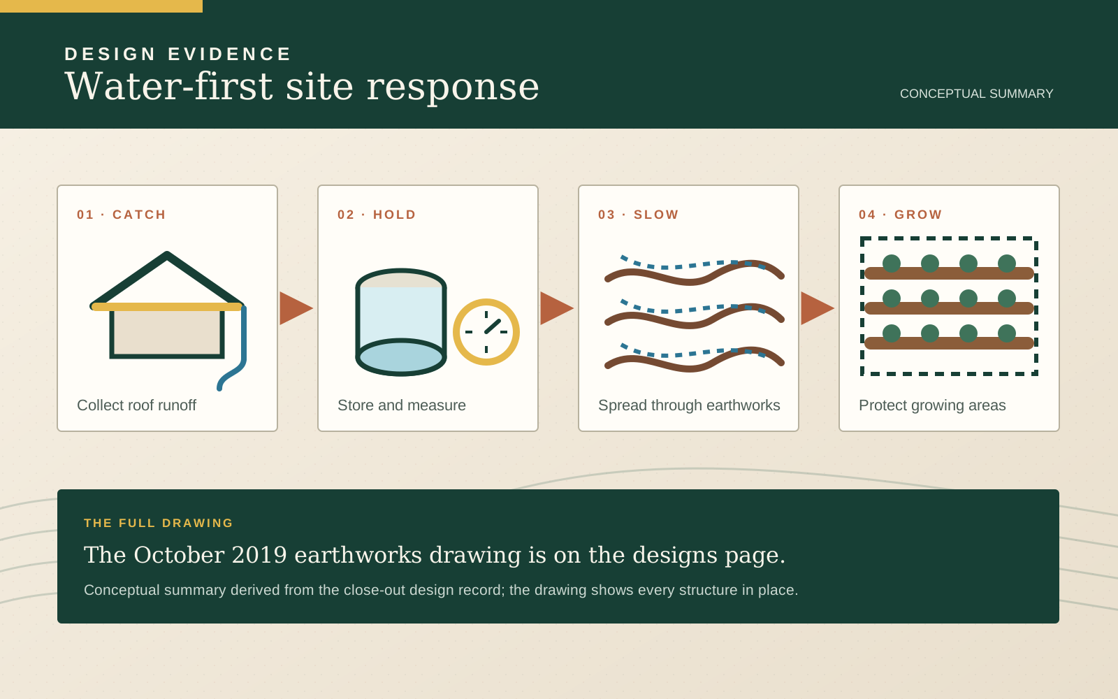
Design recordWater design summary
Conceptual summary of the October 2019 earthworks and hydrology plan: roof catchment, storage, runoff capture and protected growing areas.
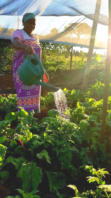
Plate 01 · Field photographWatering the vegetable beds
Watering leafy vegetables beneath shade cloth at Mzomoyethu Crèche.
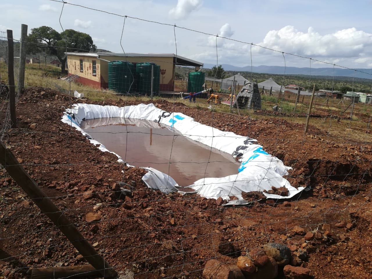
Plate 02 · Report photographRainwater in the holding pond
Water held on site after the pond and surrounding earthworks were installed, from the close-out report.
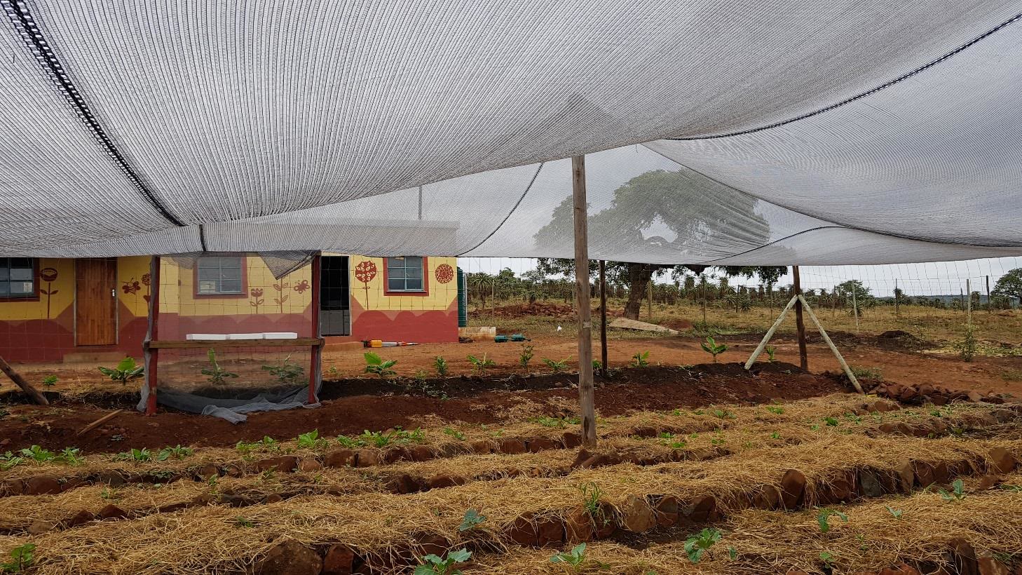
Plate 03 · Report photographProtected growing space
Mulched beds, young trees and shade protection beside the crèche, from the close-out report.
Plate 04 · Archive photographCrèche programme visit with Kingsley Holgate
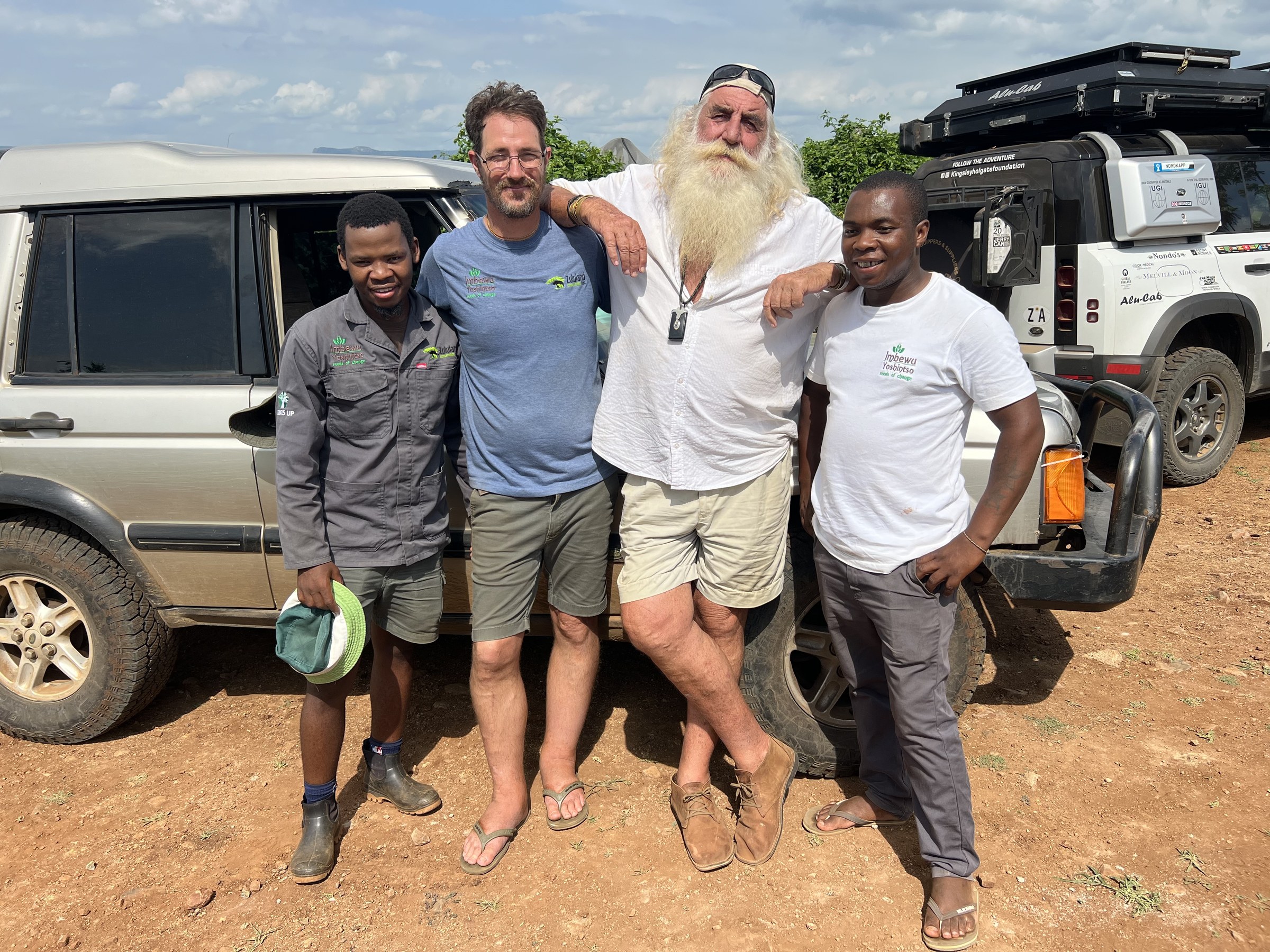
Rory, two Imbewu Yoshintso colleagues and Kingsley Holgate during the crèche programme, from Rory’s archive.
Rory Clark’s drone archive · July 2019, November 2020 and June 2022
The whole site: July 2019, November 2020, June 2022
Aerial comparison of Mzomoyethu Crèche in July 2019, November 2020 and June 2022, showing the installation of swales, a pond, tanks and shade cloth around the garden. All three photographs cover the same 75 by 75 metre area. Grey corners mark areas outside the original photographs.
Read the clip transcript
Silent loop, north up, about 75 by 75 metres of the same ground in every frame. Each change stops half way, the earlier date on one side and the later on the other. July 2019, before the works: dry, bare ground around the crèche building and its fenced yard. November 2020: swales and berms, the pond south of the building, shade cloth over the garden and tanks beside the building. June 2022, after the works: the garden under and beside the shade cloth. Then back to July 2019.
Rory Clark’s drone archive · October 2019 earthworks and hydrology plan
The October 2019 design over the same ground
The October 2019 earthworks and hydrology plan alongside aerial photographs from July 2019 and June 2022. The plan shows proposed swales, basins, tanks, pipework and a pond.
Read the clip transcript
Silent loop, north up. Each change stops half way, the two frames side by side. July 2019, before the works. October 2019, the design: the earthworks and hydrology sheet over the same photograph, with fence beds, large tree basins, raised vegetable beds, crescent tree basins, berms, swales and diversion mounds, the tanks, pipes and pond, and drip irrigation. June 2022, after the works. Then back to July 2019.
Original field clip · filmed by Rory Clark · site confirmed
The Gudlintaba swale carrying water
Water moving through the second swale between the food forest and vegetable garden at Gudlintaba Crèche, with vegetation established around it.
Read the clip transcript
Water coming to the swale. This is the second swale. Look at this, man—look at the swale. It is in the garden. This is the swale between the food forest and the vegetable garden. Look at the garden—everything is green. You see, the green is coming, although parthenium is all over.
Public project film · Gudlintaba-specific evidence
Gudlintaba Crèche drone record
Aerial footage of the Gudlintaba Crèche garden in the Mandlakazi programme.
Programme and multi-site cost sheets record the water, irrigation, planting, protection and training work.
Water measurement and irrigation management
Shade and young-tree protection
Drought-hardy planting
Training, mentorship and return observation
Why it matters
The project combined water harvesting, measured irrigation and plant protection, with follow-up visits to adjust watering and maintenance.
Site-responsive design
Water management
Field mentorship
Drought strategy
Practical training
Evidence & interpretation
Sources & evidence
Close-out report + hydrology plan + drone photographs and film + phone field clip
A conceptual design summary, aligned drone photographs, the October 2019 earthworks plan, close-out photographs and site footage document water harvesting and garden development.
Primary programme record
Mzomoyethu Crèche Food Garden Closeout Report and Mandlakazi programme reports. Used to verify the design layers, field conditions and implementation record.
Site name
Rory’s updated project record identifies Mzomoyethu as the Gudlintaba crèche, so this dossier uses the name “Mzomoyethu Crèche · Gudlintaba”. The source drawing spells it “Mzamoyethu”.
Named aerial record
Gudlintaba drone film in the project archive. The title provides site-level attribution.
Drone photographs from three dates registered to one 75 by 75 metre north-up frame: the July 2019 underlay of the October 2019 earthworks and hydrology sheet, an 8 November 2020 nadir flown at 84 m with its south-east corner completed from a second frame of the same flight at 124 m, and the 28 June 2022 nadir flown at 81 m. The design comparison adds the proposed October 2019 earthworks and hydrology plan over the same ground.
Kingsley Holgate Foundation biography
Official biography used to verify Kingsley Holgate’s identity and the foundation’s early-childhood-development work.